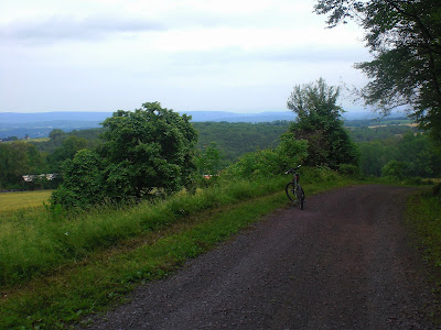
Roadside honeysuckle
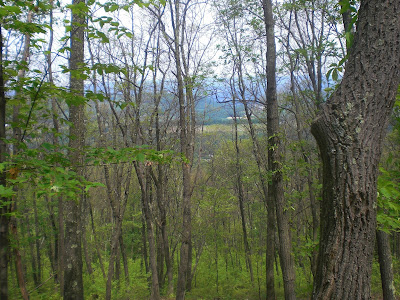
This is River Hill, but you can see Nescopeck Mountain at the full file size.
Neufer Hill Road was the usual, lightning-fast, wind-in-the-ears descent. After the US Route 11 crossing--where I waited for a while for the light to change, as usual--I entered Espy and soon afterwards turned onto Old Berwick Road. It's one of the longer non-highway roads in the area, and about as flat as one can get in northeast Pennsylvania. Still, there are a few very minor hills, just high enough to be noticeable. I passed through Espy, Almedia, and Lime Ridge without any events of note, but kept having to swerve around to avoid roadkill.
Old Berwick Road in Espy
Old Berwick Road in Lime Ridge
Roughly five miles on Old Berwick Road took me to the bridge over the Susquehanna River towards Mifflinville. When riding through Mifflinville, I usually either go down Market Street or along the outskirts. Today, I decided to explore some side roads in the middle of Mifflinville, instead. I turned onto Fourth Street and followed that to Mary Street. Along the way, there were at least half a dozen yard sales. I guess it must be some kind of centralized thing like the one that takes place in May in my neighborhood, but I'm not really a yard sale person, so I didn't know anything about it. I was surprised to find that a short stretch of Mary Street suddenly turned into a gravel road before dead-ending into the paved Kline Road.
"Is that The Mountain?"..."Of course not!" (1)
Kline Road took me to Andreas Road, where things began to get interesting. It was flat for a few tenths of a mile, with some glimpses of Knob Mountain and a few fields to the left. There were a couple of people walking along the road. People turn up in the strangest of places. Then again, the same could be said of me. I made good time for a while, but then the road turned deeper into the woods and began climbing.
Tunnel of green
Andreas Road's surface eventually became reddish and very rocky. It had rained recently, and it was a bit muddy as well. A little stream with pretty-looking ledges ran alongside the road, but there was hardly and water in it. After rising more than two hundred feet, the road suddenly transitioned to gray gravel.
Bend in the road
Andreas Road
This is what the road did to my tires.
After it became gravel, Andreas Road ran closer to civilization, with a few houses off to the left. A short distance further on, it spit me out onto Kelchner Road, where there was open farmland. Nescopeck Mountain was now just a few miles away. I headed off.
"Is that The Mountain?" ... *sigh* "Yes, that's The Mountain. Now stop slacking!"
Kelchner Road took me to Smith Hollow Road, which took me into the village of Hetlerville, which was mainly a few houses and several large farms. A herd of cows gazed at me as I passed by. I exited Hetlerville on Hetlerville Road before turning onto Zenith Road, which was unexplored territory for me. I continued heading east towards Zenith. Nescopeck Mountain drew progressively closer.
Hetlerville and Nescopeck Mountain
"What are you staring at?"
Nescopeck Mountain looming ominously overhead.
After riding for a while on Zenith Road, I saw a badly paved road heading off to the right past some mobile homes. I figured it was the road up Nescopeck Mountain, but it wasn't. It just dead-ended into someone's driveway. Luckily I only lost a minute or two from that mishap. As I rode back onto Zenith Road, I felt a few drops, but it never developed into rainfall. Soon enough, I turned onto the ominously-named Mountain Road and crossed over Interstate 80. Then I began the long, grueling climb up Nescopeck Mountain.
Interstate 80
As one might expect from the name, Mountain Road immediately began climbing steeply on the other side of Interstate 80. There were a few houses (and horses) in this stretch and I saw some decent views before heading into the deep woods.
Cornfield
Horses posing for a picture
But as I passed to the last house on Mountain Road, I ran into a bit of a problem. The road--which was quite decent and paved--suddenly turned into a rocky trail. I have a quasi-mountain bike, so I decided to forge ahead. If I had a road bike, it would've been much worse. Even a car would have been a problem. I'm pretty sure the road/trail is only meant for ATVs and mountain bikes. Mountain Road continued to rise steeply, but the going was even slower because I kept riding over large boulders and smaller bits of gravel. I left civilization behind and even the din of Interstate 80 soon faded to a distant drone.
Snarky sign
Going up
Imagine if I had one of those road bikes with millimeter-thick tires!
It was very slow going on the trail; about 7 to 8 mph. After a while, the trail suddenly dead-ended into a paved road. It continued going upwards, but not for much longer. I stopped for a bit at the summit.
On pavement
Summit!
After reaching the summit (which involved about 600 feet of climbing), I started to head down the south side of the mountain into Scotch Valley. There were a lot of curves and even a hairpin turn, but I managed to accelerate to some pretty fast speeds all the same. After about 600 feet of descent, I crossed Scotch Run (one of two in Scotch Valley) and began a 250-foot climb. On the way up the climb, I reached Scotch Valley Road. There was a decent view to the south and I stopped for some pictures.
Looking south
Scotch Valley Road and McCauley Mountain
Nescopeck Mountain from the south
Scotch Valley Road at first went through open fields, but eventually went into the woods. After a while, I reached the top of the hill and it was mostly downhill from there. There were still a few little bumps in the road, though. For several miles, the road alternated between forests and rural civilization, though neither was ever too far away. I saw a turtle out of the corner of my eye at one point; I'm sure it was the same species as the one I saw on the way back from Washingtonville back in May.
One of several large boulders I saw along the road
Scotch Valley Road
Scotch Valley Road again
Boulder and ferns
After several miles, I came to Mifflin Cross Roads, where I stopped for about five minutes to refuel. I then turned onto Mifflin X Road and headed down a steep hill and across Scotch Run (not the Scotch Run I mentioned previously, but a tributary of Catawissa Creek). And then the real fun began....
Scotch Run
After crossing Scotch Run, Mifflin X Road immediately began rising steeply. It started out going alongside a few farms, but soon became unpaved and went into the deep woods. Unpaved is a bit of an understatement, though. It wasn't as bad as Mountain Road, but there were still a lot of boulders and deep ruts. It was a very bouncy ride and went on and on and on. At one point, I entered Pennsylvania State Game Lands Number 58. The mountain continued to rise onward. I saw a stand of blueberry bushes (I think that's what they were, at least) along the road, but there weren't any berries. My tires had a hard time gaining traction on the gravel and once or twice I was completely stopped for a few moments by ruts in the road. Eventually, after 1.14 miles riding and 636 feet of vertical rise, I reached the summit. It had taken about a quarter of an hour to ride just over a mile. On most terrain, I'm about three times faster!
Going up...
...and up...
...and up...
Looking back on the road to hell the summit
The summit, at last
After reaching the summit, I rested for a while amidst the woods before heading downhill. It was nice to head downhill for a change. The road was still very bumpy and gravelly, but not as bad as it was on the way up. Still, I pressed the brakes hard all the way, to the extent that my hands were starting to hurt by the time I neared the bottom of the hill. On the other hand, the woods were fairly thin and there were some spectacular views to the north. Eventually the road went out of the woods and after passing through a bit of farmland, became paved again.
Going downhill
Forest, and mountains beyond
Going downhill again
Nearing civilization
Immediately after reaching pavement, I came upon a flock of chickens in the middle of the road. I slowed for a minute or so to wait for them to get out of the way. Then I headed downhill of the now-paved Mifflin X Road. After a while, the road took a left turn, showing me some nice views of Nescopeck Mountain.
Mifflin X Road
Golden fields
I went over Nescopeck Mountain at that little dip.
At the bottom of Mifflin X Road, I made a sharp turn onto Hofnagle School Road. Out of nowhere, I came upon a steep little 100-foot ascent. From there until Mifflinville, my course took me mostly downhill, from Hofnagle School Road to Hetlerville Road, and under Interstate 80 to Market Street. On the northern side of Mifflinville, I stopped for a few minutes at the park near the bridge before heading across the Susquehanna River.
First Nescopeck Mountain, then this.
Majestic pylon
Once I crossed the Susquehanna River, I headed west on Old Berwick Road for about five miles, towards Espy. The miles were mostly quiet and uneventful. I took a small detour through a neighborhood in Espy, though. Later, after I ascended Neufer Hill Road, I took another detour through Lionsgate.
Old Berwick Road
How about the last photo be something nice and peaceful instead of a horrible hill?
Once on Shawnee Road, I rode up Gray Street and back down, and then rode to the end of Shawnee Road. The detours were just enough to reach 36.0 miles. My time was 2:59:08 and my pace was 4:58/mile.
The vertical rise was 2690 feet and the elevation change was 5430 feet. The highest point was 1529 feet (on the first ascent up Nescopeck Mountain). The lowest was 469 feet (at the Susquehanna River).


No comments:
Post a Comment