Wispy clouds
Some scenery
The trail itself. Climbing on grass is much harder than climbing on pavement.
Looking in the general direction that I would be heading.
I navigated my way through Bloomsburg using several of the clever urban riding tricks that I've learned over the past four months: turning 270 degrees to the left at the 'no right turns' sign on Country Club Road and escaping the insanely long light by going down Oyer Ave instead of West Street. Soon enough, I crossed Fishing Creek and rode into Fernville. I rode out of Fernville on Drinker Street, along the way passing a cyclist and someone pushing a stroller while skateboarding (he gets points for originality!). After a while, I turned onto Red Mill Road--not that there was anywhere else to go--and began heading upwards along the valley of Hemlock Creek. Red Mill Road took me to Ridge Road, where the real climbing began after I crossed Hemlock Creek. The climb went up through the woods for close to 200 feet before topping out on Welliver Drive. I could have seen for miles had tall rows of corn not been blocking the view.
Ridge Road. This one is going on Commons.
View from Welliver Drive
Welliver Drive then descended steeply and quickly to Boone Road, a short, narrow, rough road that connected with Valley Road, aka Old Bloom Road. Rather than immediately crossing US Route 11, I decided to head east for a few miles and climb up via Grovania Drive to avoid the monstrosity that is Deussen Drive. Valley Road was itself pretty flat, though there were some ominous views of Jakob's Hills (which I named earlier this month) to the left.
The hills that I have named after myself
More hilly terrain
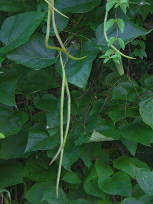
Pokeweed
This is actually Montour Ridge
After a few miles, I arrived at the Columbia County/Montour County line and turned left, crossing US Route 11 on Grovania Drive. After crossing Montour Run, I began heading upwards. The climb turned out to be hideous and exhausting, not much better than Deussen. It rose 300 feet along the ridgeline, almost nonstop. There were, at least, good views.
Grovania Drive. This one is also going on Commons.
Field at the top of the hill
Grovania Drive then made a furious descent towards Catawissa. Amazing speeds, but not too many views. At the bottom of the hill, I crossed the Susquehanna River into Catawissa. The majestic Catawissa Mountain loomed over the little borough.
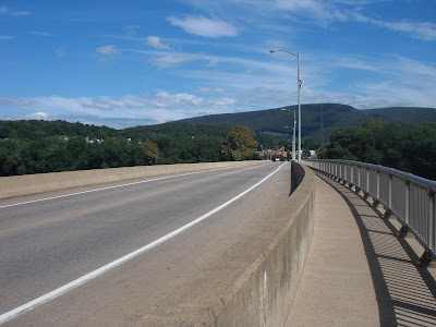
Crossing the Susquehanna River (yes, I'm using the pedestrian sidewalk again...)
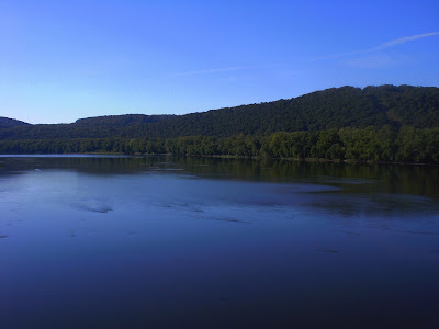
The Susquehanna River itself
Almost immediately after arriving in Catawissa, I turned onto Creek Road, an unpaved road that ran alongside Catawissa Creek at the outskirts of the borough. That took me to Pennsylvania Route 42/487, which crossed Catawissa Creek. There were a lot of geese resting in the area; I guess the birds are starting to migrate back. Soon it will be winter. I hate the cold and dark.... But I digress. The highway was pretty busy, but I wasn't on it for long before turning onto Mount Zion Drive, which was pretty much unexplored territory.
Little dam
Highways (and narrow shoulders)
Mount Zion Road began with a hideous hill that rose close to 350 feet in less than a mile. Even though it was paved, it took almost nine minutes to go a mile. But at the top, there was the idyllic scenery of Franklin Township, which I hadn't ridden in before. Even once I got to the top of the hill, it was by no means easy: a bit further on, there was a 190-foot hill to contend with.
Slacking off in Franklin Township
Scenery
Looking back in the direction of Catawissa
Cows grazing
Climbing on Mount Zion Road (again) (this one is going on Commons)
At the top of the second hill, I passed a church in the middle of nowhere and began a blisteringly fast 400-foot descent into the Susquehanna River floodplain. It was so fast that my eyes were watering profusely, despite being behind sunglasses. It must've looked like I was crying or something. At the bottom of the hill, I began heading past some more fields, with the Susquehanna River in the distance. There wouldn't be any significant climbing for three or four miles; in fact most of it was under 500 feet in elevation.
Fields and hills, something that I photograph often.
Approaching the Montour County line
A barn in a sea of green
After a while, I came to Roaring Creek--which wasn't really roaring, due to low flow conditions--and crossed into Montour County. The road continued on as State Route 2102, but the terrain barely changed.
"Roaring" Creek
State Route 2102 (this one is going to Commons)
Beautiful scenery in the Montour County panhandle
More scenery
After a couple of miles or so, I crossed the panhandle of Montour County (aka Mayberry Township), rode over Little Roaring Creek, and entered Rush Township, Northumberland County. The terrain continued to be pretty much the same for a while: straight and flat, with lots of fields. After a while, I crossed the small Logan Run and some time after that reached Pennsylvania Route 54.
Susquehanna River crossing
State Route 2002, though I doubt anyone cares about it's numbering in the quadrant route system (except me). Also going on Commons.
I wonder what happened here. A fire, I guess.
After crossing Route 54, I headed for the hills again, in the area around Blue Hill, to the south of Riverside. Unbeknownst to me, I ended up taking a wrong turn and going on a minor detour. The road I was on was a fairly gentle back road, but it did have some climbing. Eventually, I reached the end of the road and realized my wrong turn when I saw a sign directing me to Rushtown, not Riverside. I decided to simply head to Rushtown and from there to Riverside. No big deal...
Farm
Nice scenery
A hill
Apparently, even this is a quadrant route, so it's going on Commons.
...right after getting onto the road to Rushtown, there was a hideous, steep hill that I had to slog up. At least it was paved; there wasn't much gravel or dirt on this ride. And there were nice views from the top (it seems there usually are, unless a hill is in the woods).
Ugh (this is going on Commons)
Vista at the top
Soon after that, I arrived in Rushtown, which was really just a street corner, a house, and some fields. There, I saw a sign for Riverside and proceeded to head north along Sunbury Road. After a while, the road began descending through the woods and entered Riverside. Supposedly I was close to Kipps Run, but I didn't see it. The road then came out of the woods, but continued descending, all the way into the urban part of the borough. I reached the lowest point on the ride at the Susquehanna River crossing on Route 54 (429 feet), having descended almost 500 feet from Rushtown.
Approaching Riverside at last
Sunbury Road, yet another quadrant route (you know what that means)
Spectacular scenery near Rushtown
If you look very closely, you can see the cloud from the Montour County power plant
Entering Riverside
Interestingly-shaped headstone...
Unusually pretty and pristine shot of the Susquehanna River
Once I crossed the Pennsylvania Route 54 bridge, I was in Danville, and back in Montour County as well. My mom was waiting in a parking lot near the river to give me a second bottle. I then headed off through Danville and onto Bloom Road. There was some minor climbing on Bloom Road, but nothing too serious. Gradually, I passed through Mechanicsville, and then out into open countryside.
Big stone building in Danville
War memorial
Heading east on Bloom Road
The next few miles were uneventful. I crossed into Columbia County, struggled up Welliver, flew down Ridge, and then road into Fernville on Red Mill Road, and then into Bloomsburg. I took the Bloomsburg Rail Trail over to Irondale Road and from there headed up a steep hill, behind the hospital, and over to Country Club Drive.
Montour Ridge
Jakob's Hills
Plants are strange
Bloom Road in Columbia County
The much smaller Boone Road
Fishing Creek, which I cross on most of my rides
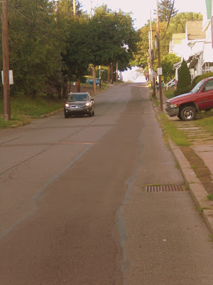
Hideous hill
Helipad
Instead of going up the hideous hill to Upper Campus, I continued following Country Club Road to Pennsylvania Route 487 and from there went down Crestwood and into the Skyview Acres neighborhood. From there, I took a short connector trail to Treeline and turned onto Cherryhill Road. Here, I came across a deer, which stamped and glared angrily at me while I took a picture. The last mile passed without further incident.
Nice views on Crestwood
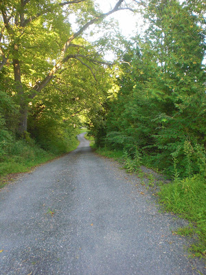
The connector trail
Totally unprocessed.
My Garmin died as I was entering Fernville, just after mile 37. At that point, my time was 2:51:19 and my pace was 4:36/mile. I'm guessing that my time for the whole ride was somewhere in the neighborhood of 3:20.
Elevation graph of the first 37 miles, including 2546 feet of climbing and 2822 feet of descending. I'm guessing that the elevation change for the whole ride was around 6,000 feet.
Route map.










No comments:
Post a Comment